Copyright © Barling Magna Parish Council
Web Design - Richard Kirton
About Us
Parish Council Meetings
Parish Council Meetings held at All Saints, Barling Magna Parish Church, Church Road, Barling, Essex.
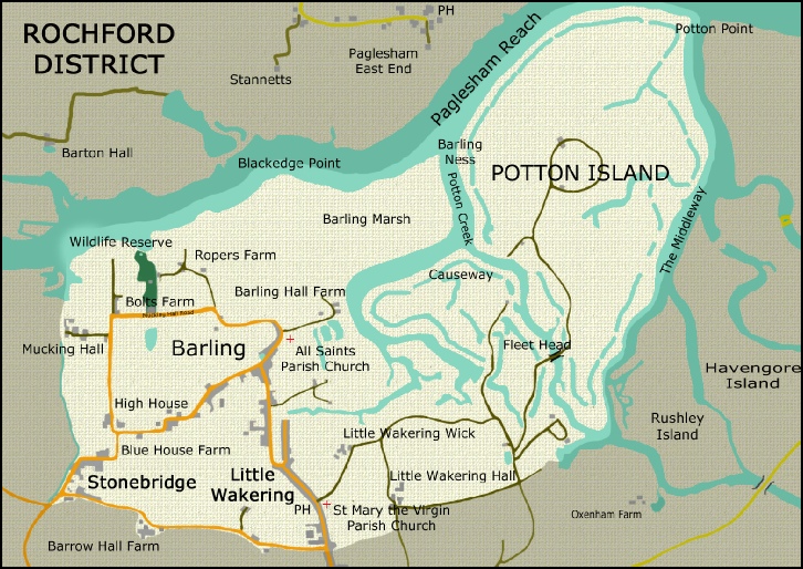
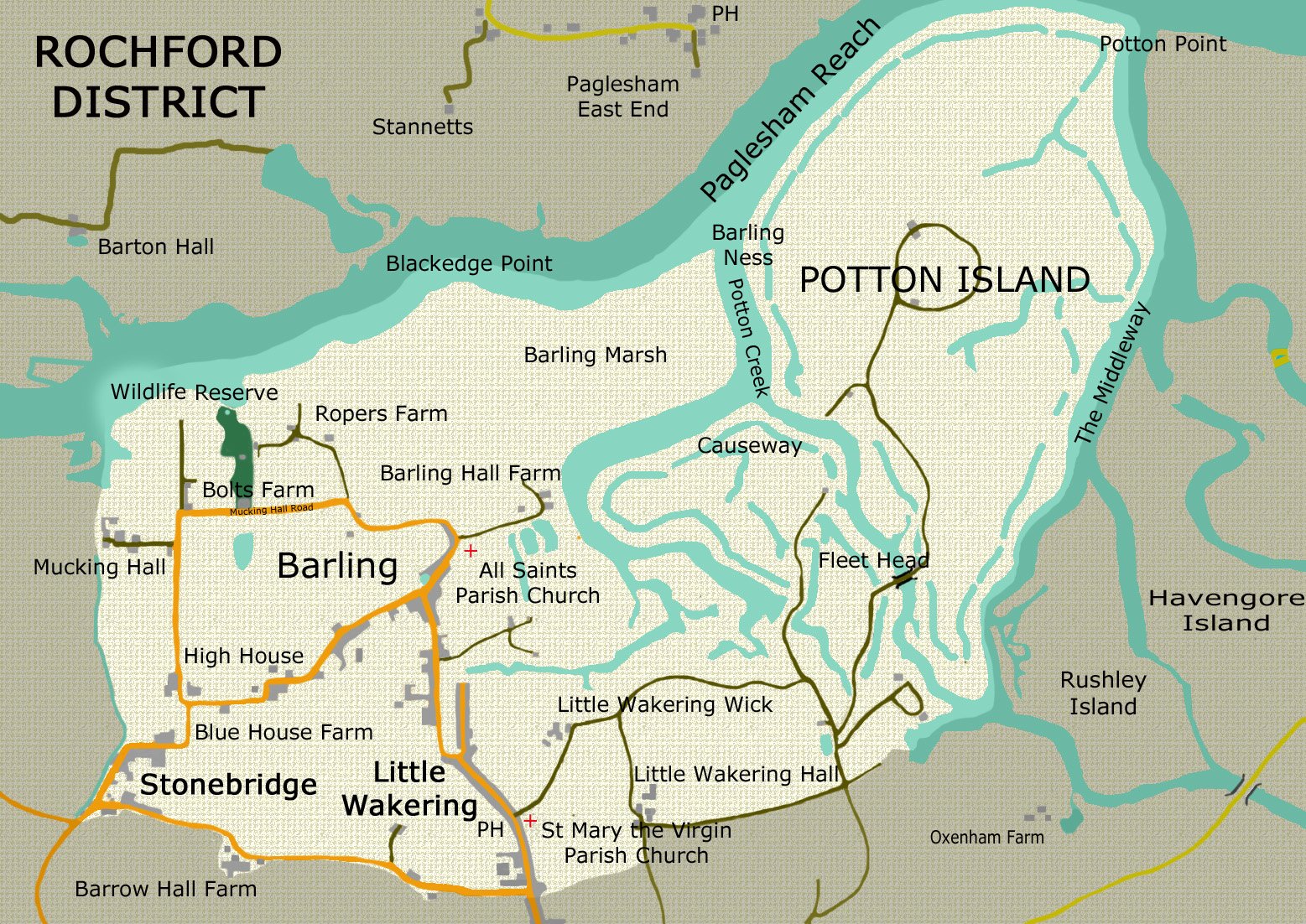
The majority of the area consists of arable farmland with the River Roach to its northern and north eastern boundary, Great Wakering to the south and south eastern boundary and Sutton Parish to the West.
On this site you will find information about Barling Magna Parish Council, its Councillors, Meetings, Policies & Procedures and the Barling Magna Wildlife Reserve (formerly the Barling Magna Millennium Wildlife Park).
You will also find information about local services, organisations, amenities and activities for which the Parish Council is not responsible and for which it cannot, therefore, accept any liability.
Barling Magna lies about three miles east of Rochford in the county of Essex and is made up of the hamlets of Barling, Little Wakering, Stonebridge and Potton Island. The civil parish of Barling Magna comes within the administrative area of the Rochford District Council.